Skip to content

{ Category Archives } North Carolina

Wilmington, NC, to Charleston, SC

Right next to it was the Orton Plantation which is clearly still in operation but farming pine trees for International Paper (that’s right, you do remember: the paper company that sold off its operations in Maine to concentrate on monoculture pine cropping in the SE US; drive through the town of Jay Maine and look at the tower in the middle of town, at the falls on the Androscoggin and admire the name still there: International Paper). … This site had some interesting archeology and displays, but unless you’re a serious student of Civil War torpedoes or Colonial artifacts, interest flags fast; it isn’t because the displays are not well-done – they are, and you have to admire the resources that the State spends here; they might cut budgets in any number of ways these days, and probably are doing so. … It resembles Beaufort in the sense that it lies at the intersection of a number of waterways, harbors the station for the pilots for the Cape Fear River and Wilmington , and has a gorgeous old town with the classic wide-set-back streets of North Carolina with lines of beautiful live oaks overhanging them. … Nowadays the southwestern horizon in G’Town outlines the mills of International Paper and Arcelor/Mittal Steel; why a a steel mill should be located in coastal South Carolina isn’t clear (though this article provides a little background), but there it is, and it’s an ugly hulk; but when the wind blows the wrong way, what you notice is the good ol’ hydrogen sulfide (i.e., rotten eggs) odor of a pulp mill.

Tagged , ,

Last stops in North Carolina (Wilmington)

Driving into Wilmington you pass through the now expected miles of commercial strip that surround most old towns in the US; at least in cases like Wilmington (or Beaufort, or any other you can name) they didn’t gut the original town to build these strips, but it likely isn’t because it wasn’t considered at the time. … There is block after block of splendid wood, brick and stone houses, brick-paved streets and nearly every one is in good condition. D7K_0123 D7K_0129 D7K_0133 D7K_0139 D7K_0142 D7K_0147 While there are some closed store-fronts the town has a feel of, if not booming prosperity, at least of thriving: lots of young people, interesting shops, very good restaurants and well-maintained civic infrastructure. … It mentions the beach areas of Wrightsville, Carolina and Kure Beach, but having driven down there we can say that they are just as horrendously overbuilt and crowded as every other beach town we’ve seen in North Carolina. … We took the afternoon of a cold, grey windy day to look at the North Carolina aquarium at Cape Fear ; note the paragraph: “It is the fifth-oldest surviving English place name in the U.S.” – who knew there was such a classification?

Tagged ,

Last stops in North Carolina

To see more, we took a little flat-bottomed skiff ferry out to Shackleford Banks at the mouth of Beaufort Inlet, close to the spot where Blackbeard’s sunken ship, the Queen Anne’s Revenge, is being excavated from the sand bank which has covered her for almost 300 years. … The three we did see were too busy cropping breakfast from amongst the sand dunes and under scrub pines to expend energy running with the wind, but it was easy to imagine what a sight it must be when they do gallop over the deserted beach. Lani would have been pleased to hear our ferryman tell the story of Rachel Carson’s work to make people realize that the DDT runoff from upland farms had killed the fish and birds along the coast, and then praise the work that had been done to clean up the rivers that were carrying poisons to the estuaries. … To get from Beaufort to Wilmington, you have to drive inland in order to get around Camp Lejeune, and it’s a long detour as Lejeune is enormous and includes a big estuary.

Lighthouses

Again, I am surprised by the things I don’t know (well, I hear you say, why wouldn’t you be!). I have always been struck by the bold black and white patterns painted on the Banks lighthouses, but never thought to ask if it had any significance. Well, of course, it does. The patters are what are called the “daymark” of the light: the pattern which enables a mariner to distinguish it from another Banks light during the day, when the flash pattern isn’t visible.

Tagged ,

Tide, Wind and Thin Water

In the course of the visit we asked what the average range of the tides in the Sound is, and got one of those fun reactions that makes you realize you are REALLY out of your range: Essentially, there are no tides in the Sound; the outer banks being such a complete barrier, with few inlets, block any tidal effect.

…The pressure of that wind-driven tidal wave with no room for it to escape through the two or three inlets meant that it created a whole new inlet and washed across the banks from inside toward the ocean. … For an image of how this works, consider a big washtub filled to about 4″ from the top; pick one end up slowly until the water reaches the edge, then drop the edge you’ve picked up; what happens?

… Add to this that Pamlico Sound is essentially nowhere more than about 20 feet deep, and you can begin to grasp what happens when the wind blows at hurricane force across the ocean-equivalent of a puddle 1″ deep.

Tagged , ,

OBX to SBX

We woke up this morning across from a busy yacht harbor protected from the ocean by Carrot Island, inhabited only by a herd of wild horses we are told we will see when the tide changes. … We saw the penned-up, not-so-wild ponies halfway down the island, stopped to follow a nearly birdless wildlife trail for 3/4 of a mile through stands of long-leaf pines and cedars on the Sound side of yet another long, thin island. … Courtesy of the US Navy, which built the Silver Lake harbor in the early years of WW II D7K_9973 newer inns and houses cluster around the port from which our second ferry left yesterday to take us across to Cedar Island and onto the mainland again. … The miles and miles of marsh and shrub leave little room for the rusted trailers, semis and rundown shingled shacks that house the fisherman and backwoods population of a county that makes Maine’s Washington County look rich.

Tagged

Birds and Bear

The trips are inexpensive, and the beauty of them is that you show up at the time and place specified and you’re taken in hand by experienced (well, mostly – we had one exception), led to the places where the action is, and are in the company of others who are interested in the same kind of experience.

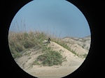
…By the time we joined him, he had two powerful scopes focused on an immature Peregrine falcon on a sand dune. IMG_6525 He then turned one of the scopes around and showed us three terns – a Forster’s, a Sandwich, and a Royal, all standing in a line at the water’s edge.

…By this time, we were late back and couldn’t stop for the truly magnificent sight of hundreds of pintail ducks feeding in flooded fields on the other side of the road, so there was no way of verifying the presence of other kinds of ducks among them. D7K_9752<D7K_9704 Friday Dan went off in the afternoon for a WoW adventure billed as a walk through tidal swamps. … Also seen: American Oystercatchers D7K_9833 and a flight of Tundra swans incoming from Canada to their wintering grounds in Pea Island NWR: a magnificent sight in the setting sun and honking to each other as they lined up for the approach.D7K_9801 All in all, a terrific, well-organized week of seeing beautiful birds and places, in good company, with no lines at restaurants (the few remaining open that is), all this by the ocean.

Tagged ,

Roanoke Island, Part 1

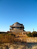
It turns out that while the **paved** highway 12 ends at Milepost 12 at Corolla, NC, the State of NC considers that the beach from there north to the Virginia line is Beach Highway 12: it’s a state highway: police cars, state highway regs apply, speed limits parking rules, etc. D7K_9488 Not only that, but about 8 or 9 miles up there, there is an unincorporated town named Corova (Caro[lina] + Virgini[A]) back in the dunes: a fire and rescue department, post office delivery routes, power lines, all set in the midst of these dunes and sand roads, as if it were perfectly normal to live out there where the only access is via the beach. Wikipedia doesn’t quite get it right , and Corova’s site is more of a promotional effort, but you get the idea: there are a massive number of HUGE houses built back there in the dunes, houses on the order of 5000+ sq. ft., which rent to large numbers of people, or a big family group, who share the cost for a week or more.IMG_6436 We took the two-hour trip and headed off in a 4-wheel drive to go see what you expect to be wild horses in a wild location, only to find them grazing on the lawns and under the carports of houses in a beach suburb; very dislocating! … The state road did not actually reach beyond Duck until 1957, and a large number of residents of Corolla commuted up the beach every day to work in Virginia, as it was (and still is) far shorter by that route than via the state highway system. Because there are now fences at the Virginia line (and at Corolla) to prevent the wild horse populations from expanding north or south, Virginia issued permits to 60 or so residents of Corolla who are still allowed to commute to their jobs via the beach and to pass through the gate in the fence at the NC/Virginia line.

From Virginia into North Carolina

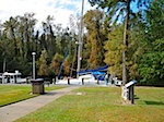
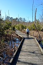
What was more fun was the way the center was situated: it was right off Route 17, and right on the edge of the Intracoastal Waterway; on the west side of the parking area were docks for boaters on the ICW. IMG_6332 When we walked into the center, the woman asked if we were off a boat – you get an idea of how seedy (or yacht-y, take your pick) we were looking! … We ended this leg at Elizabeth City for lunch, where there were a few ICW’ers tied up to wait out the Northeaster that was full of rain. D7K_9335 We spent the next two nights in Historic Bath, North Carolina, with a side trip to Washington and New Bern, NC, and to Goose Creek State Park. … We took a wander on a well-done boardwalk in Goose Creek State Park, and while the season wasn’t the best for wildlife viewing, we did manage to find a Yellow-Rump Warbler and a hairy woodpecker. D7K_9365 IMG_6373 D7K_9369 Bath had a small marina with a lot of undistinguished plastic clorox bottles in it, but it had also been homeport to a gorgeous old Herreshoff sloop, Margaret ( more here ), which had been carried ashore when her chain broke during hurricane Irene. … In the process, we asked them what the normal range of the tide is in the Sound and were fascinated to learn that because the barrier islands so effectively insulate the Sound from ocean tides, it is the wind which controls what appears to be tide: a strong easterly drives the Sound water up into the rivers and creeks; a westerly drains them out and piles up the water against the barrier islands, and in the case of really strong westerlies, cause a splash-over from the inside of the barrier islands into the ocean.

0 visitors online now
0 guests, 0 members
Max visitors today: 1 at 09:22 am UTC
This month: 2 at 02-05-2025 05:53 pm UTC
This year: 2 at 01-27-2025 10:16 am UTC
All time: 105 at 01-19-2020 11:49 am UTC