Skip to content

Tide, Wind and Thin Water

As we drove into North Carolina, through Elizabeth City and west towards (Historic) Bath (NC), we kept noticing that the tidal creeks were very full, and like good Yankees assumed that that meant the tide was high. Except it seemed unusually high, lapping over the bottoms of trees and over grassy points, and it wasn’t the new moon.

Next day we visited the Estuarium at Washington, a really interesting museum dedicated to explaining the dynamics of Pamlico (and Albemarle) Sound(s). In the course of the visit we asked what the average range of the tides in the Sound is, and got one of those fun reactions that makes you realize you are REALLY out of your range:

Essentially, there are no tides in the Sound; the outer banks being such a complete barrier, with few inlets, block any tidal effect. The wind rules: an easterly blows the water up into the rivers and creeks on the west side of the sound, and westerlies reverse the process. What we were seeing was the effect of a NE wind that was blowing hard and steadily. In New Bern, it pushed the tide up into the low-lying streets by the harbor. In hindsight, it seems to me that this is the sort of thing that everyone must know and we were just behind the eightball.

Here’s where it gets even more interesting. We know that Irene, in August this summer, passed inland of the outer banks, so picture the wind pattern:

  • The leading edge, rotating CCW, blows the water of the sound all into the western ends of the sound, and in serious quantities: water was often 10 – 15 feet above its usual levels.
  • As the eye passes the sound, the wind reverses and blows all that water back east, against the outer banks. The result was a huge wash-over from inside the sound over the banks in a seaward direction. The new inlet that it breached just south of Oregon Inlet, was blown through from the inside of the banks, towards the ocean. The pressure of that wind-driven tidal wave with no room for it to escape through the two or three inlets meant that it created a whole new inlet and washed across the banks from inside toward the ocean. Apparently so much water poured through Oregon Inlet that it scoured it out far more effectively than any number of Corps of Engineers dredges.
  • For an image of how this works, consider a big washtub filled to about 4″ from the top; pick one end up slowly until the water reaches the edge, then drop the edge you’ve picked up; what happens? That water essentially runs downhill and all slops over the end you dropped. Scale this up to 3000 sq. miles of water, pushed by hurricane force winds, and you begin to get a sense of the scale.

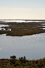
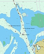
Add to this that Pamlico Sound is essentially nowhere more than about 20 feet deep, and you can begin to grasp what happens when the wind blows at hurricane force across the ocean-equivalent of a puddle 1″ deep.

It’s hard to grasp how thin the water out there is. Here are some images of the GPS track of the ferry from the southern tip of Ocracoke SE to Cedar Island (the ferry track is marked by the orange hyhen line); note the soundings from the NOAA ENC charts: Ocracoke-CedarIsland-a Ocracoke-CedarIsland-b Screen shot 2011-11-14 at 22.06.26 Screen shot 2011-11-14 at 21.50.10

This is written in Beaufort, NC, a really lovely town, full of ICW boats of every shape, persuasion and condition. Here there is a diurnal tide, with an average height of 2 – 3 feet, according to our local informant, the skipper of the skiff who ran us out to Shackleford Bank. He has a 100 ton Master’s license and was running us about in a 23 foot flats skiff.

Tagged , ,

OBX to SBX

Guess why NC leaves out the “outer” in the abbreviation for Southern Outer Banks?

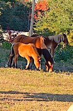
We woke up this morning across from a busy yacht harbor protected from the ocean by Carrot Island, inhabited only by a herd of wild horses we are told we will see when the tide changes. Horses… tides? It seems the ponies appear when the tide ebbs to eat the plants along the edge of the marsh grass. We’ll see. It is 70° and sunny, so it is no hardship to sit in the rocking chairs on our balcony and wait for them to appear.

The two-day journey from Roanoke to Beaufort took two days and two ferry rides. The first, from the tip of Cape Hatteras to Ocracoke, is free and takes about forty minutes. The ferry weaves its way between shoal waters shallow enough for birds to stand in – those who aren’t following the ferry in shrieking clouds D7K_9915 D7K_9919 diving into the wake and criss-crossing over the decks. We saw the penned-up, not-so-wild ponies halfway down the island, stopped to follow a nearly birdless wildlife trail for 3/4 of a mile through stands of long-leaf pines and cedars on the Sound side of yet another long, thin island. The other side is all beach, stretching for miles and empty except for a few surf fishermen’s trucks. There is not much to see or do this time of year, but the beach smells good and is very clean!

The town of Ocracoke at the southern tip is not unlike an old Maine or Cape Cod fishing village. The houses are small, mostly shingled and quite close together. There are bikes and golf carts for rent, and a lot of people use them. There is not much to do except fish and go to the beach. We spent the night in a B & B whose owner had been invited to Little Cranberry Island in Maine by the Island Institute last November. He had also visited the school on North Haven, Jan, but didn’t remember meeting any pretty woman named Jen… He was preoccupied anyway with a female visitor who had come to decorate his B&B with white fake Christmas trees. Luckily, she had only finished two rooms by the time we claimed the undecorated third.

Courtesy of the US Navy, which built the Silver Lake harbor in the early years of WW II D7K_9973 newer inns and houses cluster around the port from which our second ferry left yesterday to take us across to Cedar Island and onto the mainland again. The 36 miles or so of routes 12 and 70 that brought us to Beaufort ran through the region the locals call Down East. The miles and miles of marsh and shrub leave little room for the rusted trailers, semis and rundown shingled shacks that house the fisherman and backwoods population of a county that makes Maine’s Washington County look rich. Quite a contrast to Beaufort itself, which is the third oldest incorporated town in North Carolina after Bath and New Bern. More about this lovely spot after we have finished with the laundromat and begun to explore.

Hugs to all.

Tagged

Birds and Bear

Before setting off on our travels we discovered an organization called Wings over Water, based in Manteo, NC. The list at the bottom of their home page displays the sponsors, but it is heavily supported by the US Department of Fish and Wildlife and their National Wildlife Refuges (and yes, your tax $$; applause please – this is a worthy cause). The trips are inexpensive, and the beauty of them is that you show up at the time and place specified and you’re taken in hand by experienced (well, mostly – we had one exception), led to the places where the action is, and are in the company of others who are interested in the same kind of experience.

One of the things about going birding with other people is that they invariably know more and have better equipment than we do. The show-off factor almost always makes everyone very generous about sharing both.D7K_9498

We get to walk – not too fast and with frequent stops – into places we would not otherwise know how to reach (or be allowed to: some are closed except for this week of programs). If alone, it would probably take us an hour to identify the small black spot on the water. With experts, you take a peek in their scopes, et voilà, your merganser or tundra swans. It is quite magnificent! Beginner’s luck occasionally allows us to spot something interesting first, so we “pay back” the experts in small ways.ß

The first morning – Tuesday, November 8th – we walked around the edge of North Pond on Pea Island. The two huge ponds in this refuge were built by the Corps of Engineers in 1936 (don’t you wish your tax $$ for the Corps always were so well used!) and saw a great many geese, ducks, egrets, ibis, swans and small shorebirds. D7K_9501
D7K_9517 <D7K_9522

D7K_9695


The next morning we went to The Hook, near the Cape Hatteras lighthouse. An intrepid widow in her late seventies, whose husband had been an ardent birder, drove us and a bird photographer’s wife onto the beach in her Jeep, stopping every time we saw a flock of ducks or huddle of shore birds. It was a magnificent spot where the locals claim the Labrador current runs into the Gulf Stream off the Cape that is known as the Graveyard of the Atlantic. Identification was largely guesswork, plus some expertise gleaned from the previous day’s serious birders, until our driver got a call from the next day’s tour leader, who just happened to be scouting out the beach on the other side of a large tide pool. By the time we joined him, he had two powerful scopes focused on an immature Peregrine falcon on a sand dune.
IMG_6525
He then turned one of the scopes around and showed us three terns – a Forster’s, a Sandwich, and a Royal, all standing in a line at the water’s edge. A few more firsts were then found among the small waders at the edge of the surf before we disbanded and headed to lunch at the Buxton Munch – one of the last Hippie restaurants left on the Outer Banks. Excellent.

The Hook at Cape Hatteras is a spectacular place: dunes, wild surf and currents, miles of beach. You know you’re standing at the edge of a fabled meeting place of ocean and land and it seems to match up to your expectations. The surf was explosive off the point, and were were casually told it looked pretty calm. We knew for a certainty we wouldn’t care to be anywhere within many many miles of it in any size boat.
D7K_9607
See a movie clip of it here.

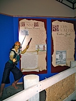
Besides a lot of grizzly tales of shipwrecks, the museum at the other end of the island yielded some interesting information about the areas renowned pirates. A favorite picture is included for Estelle – in case she’s lacking in career ideas.IMG_6532


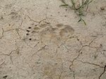
Thursday’s expedition was a seriously boring three-hour ride on the back of a truck-drawn flatbed on wheels. We sat on hard wooden benches and travelled down dirt roads along fields where 10% of the farmers’ crops had been left standing and been recently flooded with water from the surrounding swamps for the use of migrating waterfowl. For three hours, we saw nothing but a few hawks, meadowlarks and turtles as a cold wind came up and a young volunteer chatted unknowledgeably about the surroundings. Then he spotted some bear scat, then some fresh bear tracks,IMG_6537 and a few minutes later a young black bear helping himself to grain in a distant field. By this time, we were late back and couldn’t stop for the truly magnificent sight of hundreds of pintail ducks feeding in flooded fields on the other side of the road, so there was no way of verifying the presence of other kinds of ducks among them.
D7K_9752<D7K_9704


Friday Dan went off in the afternoon for a WoW adventure billed as a walk through tidal swamps. Conditions were mixed: bright sunshine, crystal-clear air but with a howling wind out of the NW and about 50°. Boots were suggested, but upon inquiring they said sure, wear sneakers and shorts. So Dan wore shorts, to the amazement of the other participants, with a game explanation that everyone in Maine wears shorts all winter.

Thrashing through marsh grass (and 3″ deep water) was fine; trying to locate shy, devious little birds like Saltmarsh D7K_9785 and Marsh Sparrows was less entrancing, but they were found. Also seen: American Oystercatchers
D7K_9833 and a flight of Tundra swans incoming from Canada to their wintering grounds in Pea Island NWR: a magnificent sight in the setting sun and honking to each other as they lined up for the approach.D7K_9801


All in all, a terrific, well-organized week of seeing beautiful birds and places, in good company, with no lines at restaurants (the few remaining open that is), all this by the ocean. What more could you ask?

Tagged ,

Roanoke Island, Part 1

OK, we arrived on Roanoke Island Sunday afternoon.

We’re staying in a lovely little spot called the Scarborough House Inn, a couple of blocks from the harbor in Manteo, run by Sally and Phil Scarborough. Their families have been here since the Year 1, and they are the nicest kind of people you can imagine. Phil and I were talking out front and his second cousin drove by, whom Phil fondly calls “that varmint”; the driver of every other car going by waves. He’s got a nice twinkle and befitting an engineer retired from running 250 and 320 foot Coast Guard ships, he has stories.

Monday was a day of rest, in that we had nothing scheduled, but of course, it turned out to be a day of exploration, i.e., not rest. We drove over to the Outer Banks and north to Carolla, which is what the guidebooks tell you is the End of the Road, which is NC Highway 12. There you can hire a 4-wheel-drive to take you up the beach and back into the dunes to see the wild horses (and here you thought it was only at Assateague and Chincoteague, in Virginia, right? Is there anyone here who does not remember the book Misty of Chincoteague?)

Well, the reality is a little more complex. It turns out that while the **paved** highway 12 ends at Milepost 12 at Corolla, NC, the State of NC considers that the beach from there north to the Virginia line is Beach Highway 12: it’s a state highway: police cars, state highway regs apply, speed limits, parking rules, etc.
D7K_9488

Not only that, but about 8 or 9 miles up there, there is an unincorporated town named Corova (Caro[lina] + Virgini[A]) back in the dunes: a fire and rescue department, post office delivery routes, power lines, all set in the midst of these dunes and sand roads, as if it were perfectly normal to live out there where the only access is via the beach.

Wikipedia doesn’t quite get it right, and Corova’s site is more of a promotional effort, but you get the idea: there are a massive number of HUGE houses built back there in the dunes, houses on the order of 5000+ sq. ft., which rent to large numbers of people, or a big family group, who share the cost for a week or more.IMG_6436

We took the two-hour trip and headed off in a 4-wheel drive to go see what you expect to be wild horses in a wild location, only to find them grazing on the lawns and under the carports of houses in a beach suburb; very dislocating! It was late afternoon, with low evening light, and we had a fine time, we saw the horses we expected to see, but discovered a place and way of life we did not at all expect to see!
D7K_9439
D7K_9450

It gets more interesting. The state road did not actually reach beyond Duck until 1957, and a large number of residents of Corolla commuted up the beach every day to work in Virginia, as it was (and still is) far shorter by that route than via the state highway system. Because there are now fences at the Virginia line (and at Corolla) to prevent the wild horse populations from expanding north or south, Virginia issued permits to 60 or so residents of Corolla who are still allowed to commute to their jobs via the beach and to pass through the gate in the fence at the NC/Virginia line.

Still, even with all this development, it’s a lovely beach.D7K_9481

On the way up to Carolla we did a drive-by on the Wright Brothers Memorial:D7K_9413

Carolla has a lighthouse, D7K_9427 and a public park on the site of one of the many hunting clubs from the 1880’s. These places were huge, and attracted lots of rich “sports” from NYC and elsewhere to come massacre waterfowl by the hundreds.
IMG_6423

Back in Manteo we took a quick turn through the National Historic Site at the Raleigh Colony. It’s a sad tale but the NPS has managed to imbue the disastrous ending of the colony (in a video) with a pretense that it was somehow the forerunner of the American desire for freedom and independence; it’s a pretty shaky interpretation.

We’ve had spectacular weather, and despite the pretty appalling, dense development of houses right up to the dunes, there is a lot of gorgeous beach, especially in the Cape Hatteras National Seashore. Unfortunately, the owners of these places can still get both flood and homeowners insurance; we weren’t too sympathetic listening to a couple of them complain about the high deductibles, or the fact that FEMA disallows some kinds of reimbursement. I kept my mouth firmly buttoned to keep from saying that I didn’t really want my tax $$ (via FEMA) to subsidize enormous houses in fragile environments in the path of frequent hurricanes.

They begin to roll up the sidewalks here about now, and really seriously after Thanksgiving or Christmas. As it is, finding a place to have dinner is not a simple task.

From Virginia into North Carolina

After a wonderful stay in Williamsburg, we pulled up stakes and headed south. Good old Route 17 led us around Newport News, across the James River Bridge, down towards Portsmouth, and thankfully, west of Norfolk.

Traveling down the Colonial Parkway (connecting Jamestown, Williamsburg and Yorktown) you pass great long piers running out into the York River where we saw two of what appeared to us to be Bath-built destroyers tied up to the pier.

D7K_9325 D7K_9326

It turns out the west side of the York is the Naval munitions depot, a place that runs well back into early American history. If you look at this area in Google Maps you’ll see the depot encompasses an enormous piece of land; certainly as your drive though it on the Parkway it is heavily wooded and it doubtless has huge expanses of forest which are home to a lot of wildlife. It’s one more of those ironies: that military reservations should, in their need for secrecy and isolation, protect vast parts of the country against the kind of development that might otherwise adversely impact the wildlife native to the area.

We crossed into North Carolina, our FIRST really new state (we’d been to Mt. Vernon, Arlington, and other suburbs of DC before this trip). We were looking for a tourist information center and were not disappointed. A couple of miles south of the line, there it was, and they had the maps and information we wanted. What was more fun was the way the center was situated: it was right off Route 17, and right on the edge of the Intracoastal Waterway; on the west side of the parking area were docks for boaters on the ICW.
IMG_6332
When we walked into the center, the woman asked if we were off a boat – you get an idea of how seedy (or yacht-y, take your pick) we were looking! The ICW here runs down the eastern edge of the Great Dismal Swamp for many miles, and sure enough, there were sailboats and powerboats streaming south. Interestingly, this section of the ICW was originally developed as a canal to connect Chesapeake Bay with Albemarle Sound in 1805. As usual, the history quickly got more complicated.
We ended this leg at Elizabeth City for lunch, where there were a few ICW’ers tied up to wait out the Northeaster that was full of rain.
D7K_9335

We spent the next two nights in Historic Bath, North Carolina, with a side trip to Washington and New Bern, NC, and to Goose Creek State Park.

The highlights of Historic Bath were:

  • The astonishing variety of historic signs in the town.
  • The menu at one of the local restaurants (where the vegetable side dishes on offer were: salad, slaw, mac salad, potato salad, baked potato, apple sauce).
  • The young newlyweds at breakfast: he from NJ, she from next door, Washington, NC; really nice people, having just done the big family wedding and off on their honeymoon to Cancun. It turned out she had just graduated from Brooklyn Law School, and while she hadn’t been lucky enough to have Katie’s old classmate and great friend and much-missed SLC classmate, the late Eve Cary, as a prof., she had heard wonderful things of Eve’s continuing activities at BLS, even after she stopped teaching. It warmed our hearts to talk with them, not something that always happens when you have breakfast with strangers!

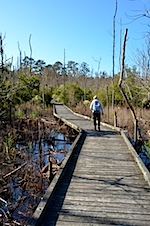
We took a wander on a well-done boardwalk in Goose Creek State Park, and while the season wasn’t the best for wildlife viewing, we did manage to find a Yellow-Rump Warbler and a hairy woodpecker.

D7K_9365 IMG_6373 D7K_9369

Bath had a small marina with a lot of undistinguished plastic clorox bottles in it, but it had also been homeport to a gorgeous old 66 ft. Herreshoff cutter, Margaret (more here), which had been carried ashore when her chain broke during hurricane Irene. We hope the owner finds the means to get her afloat soon; there has apparently been looting on her since the accident.

During the two days we spent in the Bath area there was a steady NE wind blowing, and we noticed how high the tide was along many of the rood that were near the creeks and bays. In Washington, we visited the Estuarium, an excellent museum and information center devoted to education and outreach on the issues related to estuaries, and in this case, the Pamlico Sound. It is an extremely well-done effort. In the process, we asked them what the normal range of the tide is in the Sound and were fascinated to learn that because the barrier islands so effectively insulate the Sound from ocean tides, it is the wind which controls what appears to be tide: a strong easterly drives the Sound water up into the rivers and creeks; a westerly drains them out and piles up the water against the barrier islands, and in the case of really strong westerlies, cause a splash-over from the inside of the barrier islands into the ocean. The changes in water level can be a matter of many feet. Certainly, while we were in New Bern, we found a couple of the low-lying street along the shore partly flooded due to the easterly wind.
Found in New Bern, a beautiful old buy boat from the Chesapeake, which looked to me to have fallen on hard times. D7K_9354

Sunday, 6 November, we headed for Manteo, on Roanoke Island. We took NC 264, along the south side of the peninsula, via Englehard. If you look at the map, you see towns listed on the map, but this has to be one of the most monotonous, isolated places we’ve seen in a while. The land is seriously FLAT, as in western Kansas flat, and the crops are pine trees (for pulp and paper), cotton, and soy beans; no stores, no restaurants, no gas stations – it was impressive.

We stopped at the Mattamuskeet National Wildlife Refuge hoping to see some of the 20 – 30,000 Tundra Swans which winter over there, but the wind was blowing hard; if the swans were there they were sheltered out of sight. But we did find a beautiful Great White Egret: D7K_9400
Lake Mattamuskeet turns out to be the largest natural lake in NC, with a fortunately failed history of attempts to drain it and farm it!

Our other stop was at Swan Quarter (that’s the town’s name; look it up!). It is home to an impressive array of shrimp and oyster draggers, all of which seemed to be tied up and many of which looked unready to go to sea.

We rolled into Manteo, found our delightful hotel, and are settled in for a week.

Yorktown

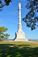
We went off to Yorktown. The battle at Yorktown was a critical event in the life of the USA-to-be, but it’s hard to get a grasp of it on the site: it’s a battlefield memorial, with lots of old emplacements and remains but little life to it. There is a hideous monument put up after decades of procrastination by Congress, the shaft of which is of Maine granite (but we didn’t learn which quarry).D7K_9318
UPDATE: My diligent researcher brother John unearthed the mystery of the origin of the Maine granite:

“Monuments were a major source of income for the Hallowell Granite Works. The Pearson Monument shows the detail that
could be accomplished by using Hallowell’s fine-grained granite. Notable Granite Works monuments include the Pilgrim’s
monument, Plymouth, Massachusetts.; Soldiers’ monument, Boston Common, Stonewall Jackson monument, New Orleans,
Louisiana, George Pullman monument, Chicago Illinois, and the Yorktown Monument, Yorktown, Virginia.”

http://www.mainememory.net/artifact/29251

And the Hallowell Granite Quarry is still in business.

On the way in to Yorktown we stopped first at the Virginia Victory Center, and yes Virginia, it is as bad as it sounds; if you ever go to Yorktown, give this a miss. The entire place, which is clearly well-funded, is aimed at the visitor with the maturity and knowledge of the average 10-year-old. We left early, and one of the staff was clearly so distraught that we would abandon their narrative in midstream that she said we would be missing the sunken ships in the basement (or somewhere…..); we thought that we all have enough sunken ships in our basements and left.

At the National Park Service site we took a short foot tour of the historic houses of Yorktown, and the NPS interpreter was terrific: great sense of humor, knowledgeable and with the capacity to blend past and present; a rare treat, as the visitor interpretive trade is often given to earnestness, or worse. He was right up there with the genuinely best of them.

We stopped for lunch (ocean scallops and crab cake) in a tavern down on the waterfront and saw speckled trout on the menu. I’ve been reading James Lee Burke novels for years, and hearing about speckled trout and this was as close as I’ve ever some to one (but I didn’t order it – Dan). Here’s what Wikipedia has to say about speckled trout.

A few more photos from Yorktown can be seen here. Note the Coast Guard buoy tender headed downstream behind that steel schooner.

Like much of the coastline we’ve seen so far, this country is FLAT. It’s lovely, but there is amazingly little relief. Navigation must be seriously complicated.

Tagged

Williamsburg

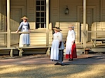
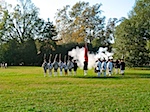
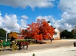
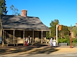
Tonight, the second of November, we have just added a night to our delightful stay in Williamsburg. Rather than stay in a hotel or B & B in town, we reserved a house inside the historic village and were given an upgrade to a cottage that fronts on the Duke of Gloucester Street in the heart of this amazing reconstruction of an eighteenth century town. Our bedroom has a working fireplace, a fourposter bed, a wing chair, an old oriental rug, and just enough room in a big closet to bring most of our carload inside to sort. The town lives all day long in front of the house: bullock carts, ladies in costume with baskets, crowds going to re-enactments in front of taverns that sell real ale and real food. Beautiful trees sport fall colors as girls and boys playing fife and drum march up and down with serious purpose.

IMG_6247 D7K_9236 D7K_9244 IMG_6289 IMG_6290 IMG_6295 IMG_6301 D7K_9313

There is a streaming video clip here of the fife and drum corps.

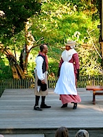
Penny would be at home in this daylong play, but it is tempered by the seasoned skill of the players, who are neither stale nor over-actors. The story being told is that of the birth of our country, and – perhaps because I have lived without the repetition of the dramas for so long, I find it riveting. For someone who slogged through sleet in Concord, Massachusetts on April 19th to remember those (from Acton!) and others who fought at the Old North Bridge, it was moving to hear Virginians act out their admiration for the New Englanders who drove the British from Boston, and called for Virginians to join them in New York. I was also glad that we had roamed the interior of Virginia for a week before coming here. It gave depth and perspective to all the references to Jefferson and Washington – even to the story of Benedict Arnold. What a collection of intellects, aspirations, dreams and privations are represented here!

Besides, this place is just plain beautiful. If, indeed, John D. Rockefeller said that his walk around Williamsburg was the most expensive walk he ever took, we can be glad he took it. There is so much that was/is worth preserving here. Even if we searched in vain for a second monument to religious freedom, the Virginian statute was cited in context tonight as a critical step in building America. Has it been forgotten so fast?

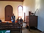
Religious freedom was also a topic at court this morning when Daniel B. Hinckley was brought to trial for not having attended Church of England services in this town.IMG_6279D7K_9283

His excuse was that he was a Roman Catholic and there were no places to worship according to his convictions in town. Under the laws of Virginia at the time (Virginia’s boundaries extended to the Pacific), he could have been tried for treason, but having a lenient judge on his side, he was fined five shillings and advised to move to Pennsylvania.

Walking about in Williamsburg can be a little unnerving when someone comes up to you dressed in period costume and wants to sell a pig or buy a haycart. As you bumble about trying to work out a suitable response they are very clever at filling in the blanks and leading you along, and you generally don’t end up buying a pig in a poke. The whole experience can be quite convincing, and fun, once you indulge in the appropriate willing suspension of disbelief….

Additional galleries of imagery from around Williamsburg.

Tagged

Fredericksburg

As we have wandered south we have been fortunate to have a series of friends who have kindly taken us in for periods ranging from 1 to 4 days, and who, in some cases, spend considerable time showing us the local sights.

We just spent a night in Fredericksburg, with Ellen and Jerry Stokes. This tale goes back to the days when Dan was working for SCA and went to the Flathead National Forest in Montana for a site visit and to look into a problem reported with one of the SCA College Program students.

The USFS person managing the SCA volunteers was Jerry Stokes, and Dan and he hit it off immediately. Being a Southern Gentleman, Jerry also invited Dan home for the night and imposed him on his household of Ellen and three small kids in Kalispell.

So when we told Jerry and Ellen we were passing though Virginia nothing would do but that we spend the night, despite them just having returned from a three-week trip to England a few days before!

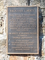
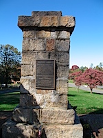
Jerry and Ellen gave us a personalized walking tour of downtown Fredericksburg, and Jerry showed us what he considers to be the most important monument in the US: to the Virginia Statute of Religious Freedom, written by Thomas Jefferson.

IMG_6200 IMG_6199

There is a monument to Mary Washington, George’s mother, a small, very well-done museum to GW’s friend, Monroe, who had an office in what is now a small museum, and a farm across the Rappahanock where GW grew up.

Fredericksburg was of course the site of some of the really dreadful Civil War battles. We are essentially giving the Civil War sites a pass on this trip, both because neither of us is fascinated by it and also because once you start to visit the Civil War sites, it’s a lifetime’s occupation, so we’ll do it in another lifetime….

But the Colonial history is fascinating, so we’re off to Williamsburg!

Tagged , ,

From Warm Springs to Cold Snow

This entry will cover a fair amount of ground, beginning with our travels from Warm Springs to spending a night in Staunton (called “Stanton” locally), traveling up onto Skyline Drive, spending the night at Big Meadow, and finally arriving to spend a night in Berryville with Polly and John Crawford and awakening in the morning to 2″ of wet snow on the ground!

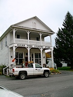
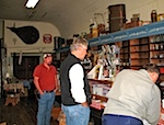
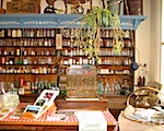
We wound our way from Warm Springs up to Staunton via Monterey and McDowell. McDowell is home to the Sugar Tree Country Store where we stopped and came away with some fun items for the grandkids and a very pleasant talk with the proprietor.
IMG_6103IMG_6106IMG_6107

At Monterey, we saw that West Virginia was seven miles up the road so we went up to cross the state line to add another state to the roster.

Staunton: we went into the Visitor Center to find out what was available for housing and were quickly installed in the Stonewall Jackson Hotel and Convention Center, which is far more charming than it sounds. Comfortable rooms, wonderful staff and right next to the Blackfriars Theater, where the American Shakespeare Company and others put on plays. We hustled over to see if we could get a seat the same night and were rewarded: a fabulous interpretation of The Tempest, there in Staunton VA; who knew?

Staunton is a delightful town. It has a huge public park, an Amtrak station, a good spread of restaurants and shops, a couple of small colleges and a lovely old downtown which is being well looked after and upgraded. We enjoyed it thoroughly.

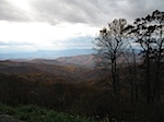
The next morning we headed up the hill towards the Skyline Drive. We used our Senior Pass for the first time to get into Shenandoah National Park for free, and wound our way along the crests towards Big Meadow Lodge where we were to spend the night. It turned out to be a little after the peak color season so we had the road very much to ourselves, picnic-ed in a deserted picnic ground (even the bears had left as there were no more soft touches to be found cooking lunch for them. One of the wonderful features of the drive was the huge variety of trees to be seen not only along the road, but out on the ridges and hills and down into the valleys; you could see by the patches of color that it is a wonderfully mixed deciduous forest, full of trees which we do not know at all – very frustrating not to be able to identify a third of the trees we were seeing.

D7K_9072D7K_9073D7K_9096IMG_6125
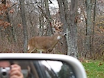
Big Meadow Lodge is a classic piece of National Park lodging: dark wood, little cabins, the central lodge with a view west over the Shenandoah and a fire going in the big fireplace. Our room was cosy, clean, comfortable and came with a full selection of deer all around the buildings.
IMG_6134IMG_6139D7K_9116

We went over to the Visitor Center the next morning to see if Dan could talk to one of the Student Conservation Association volunteers. SCA (for which Dan worked for 10 years) provides volunteer college students who work in practically every aspect of the services and jobs of the principal Federal Land Management agencies (USNPS, USFS, BLM, USFWS) as well as many state park systems and other private management agencies like The Nature Conservancy. Dan used to oversee all those positions, and never having been to Shenandoah, was curious to talk to the SCA volunteer there. He was a recent college graduate, Philosophy and English, and having a great time and hoping to be able to find a way to develop the opportunity, even in the face of continuous federal and state budget cuts for such “unimportant” things as national parks and forests. A high percentage of these volunteers end up with professional career positions with one of the federal and state resource management agencies.

Under increasingly grey skies the next day (Friday, 28 October), we drove the northern miles of the Drive, and came down from 3000 feet to the plains at Front Royal, and headed on towards Berryville, home of Polly and John Crawford, friends from Small Point, Maine.
IMG_6160
Both of them grew up in and around Winchester and were willing to take in two strays for two nights and let us do our laundry.

This morning we woke to an inch of wet snow on the ground, with more coming down by the minute, and with the sound of tree branches snapping and crashing all around the house. Heavy wet snow, with the leaves still on the trees, is a recipe for power outages, cars in ditches and in general a good time to put your feet up in front of the fire with a good book.
D7K_9171

John’s 4-wheel drive enabled Polly and John to give us a wonderful tour of the places where they grew up and ended up taking us into the Museum of the Shenandoah in Winchester.
D7K_9175
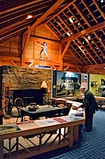
This is an excellent museum, with very well done displays of the cultural history of the area and a painting gallery full of little treasures, with two Gilbert Stuart portraits, and others by Constable, Gainsborough, Sir Joshua Reynolds, Guardi and several others; a wonderful treat in an unexpected place.

Tagged , , , , , ,

Warm Springs and Hot Springs, VA

Leaving Charlottesville we wound our way by small roads over the Shenandoah to Warm Springs. One of the prettiest stretches was along the Rockfish River Valley: it looked a lot like Switzerland in the sense that everything along the road was tidy and well organized – even the garages!

Then the route west over the mountains took us through Raphine to Warm Springs and Hot Springs, via some lovely creeks and rivers and hollows, with fall color in full,sun-soaked display.
IMG_6076

The view east towards the Blue Ridge Mountains:

BlueRidge-Panorama-web

The small secondary roads in this area are a treat to drive at this time of year – there is so little traffic that you can often just stop in the middle of the road to take a photo and have no cars at all come along for minutes on end, if at all.

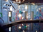
We stayed in a little place right across the road from the Jefferson Pools, some of the best hot springs either of us has ever seen, or used. Body temperature water, high flow rates, crystal clear water, and some ancient, quaint and seriously decrepit octagonal wood structures enclosing two pools: one for women and one for men; family days (bathing suit required) every so often during the week; otherwise it is suits-optional during segregated hours.

D7K_9069
IMG_0072

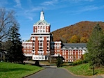
The pools are owned by The Homestead, one of the most excessively grandiose places we’ve ever laid eyes one, right up there with the mansions in Newport or Northeast Harbor. There are extensive fancy homes all around The Homestead, and it looked as if a good half of them were for sale, which likely means many more were as well but not mentioning it publicly. Not our style of neighborhood….
IMG_6087

We went in the pools that afternoon and had delightful soaks in completely empty pools, an experience not to be missed.

Tagged , , ,
0 visitors online now
0 guests, 0 members
Max visitors today: 2 at 04:50 pm UTC
This month: 2 at 02-05-2025 05:53 pm UTC
This year: 2 at 01-27-2025 10:16 am UTC
All time: 105 at 01-19-2020 11:49 am UTC